Flash flooding possible through Friday morning and Tropical Storm Cindy has formed
Raleigh and some surrounding areas are under a flood advisory through Friday while a slow-moving low-pressure system drops the last of its moisture before finally moving on.
Dan Liens, a meteorologist with the National Weather Service in Raleigh, said heavy rain Thursday morning may have caused flooding in low-lying areas around the Triangle, and showers expected at midday likely would cause some more with an additional quarter-inch to half-inch of rain.
After Thursday morning’s storms, Duke Energy reported about 600 customers without power in the Triangle, and about 2,000 outages in Alamance County, to the west.
Generally, Liens said, flooding would be most likely Thursday in areas west of U.S. 1, with a watch in effect for Wake, Durham, Orange, Chatham, Lee, Harnett, Moore and Cumberland counties, as well as others further west.
Relatively little rain in the area on Wednesday helped reduce flooding expected with the lingering system, Liens said, but Thursday’s repeat showers would make localized flooding more likely.
When will the rain stop?
So far this week, the highest rainfall amounts in the state have mostly been in the mountains and foothills, with areas around Hickory, Asheville and Marion reporting 6 inches of rain or more. Kannapolis, near Charlotte, had several inches of rain resulting in flooding that forced the evacuation of a neighborhood on Wednesday.
“The good news is, this will finally start to exit the area tonight, so there will be a little improvement,” Liens said.
Friday and Saturday could still bring some showers, Liens said, but by Saturday evening the low-pressure system should be gone and the region will begin to dry out.
Latest on Tropical Storm Bret & Hurricane Cindy chances
Meanwhile, in the Atlantic Ocean, Tropical Storm Bret continued Thursday tracking south of Puerto Rico and will cross the Lesser Antilles Thursday night. It’s expected to fall apart as it moves into the Caribbean Sea without threatening the U.S. mainland.
Also in the Atlantic, a disturbance that appeared to be forming earlier in the week has disappeared from forecast maps, but a new, fourth system appeared.
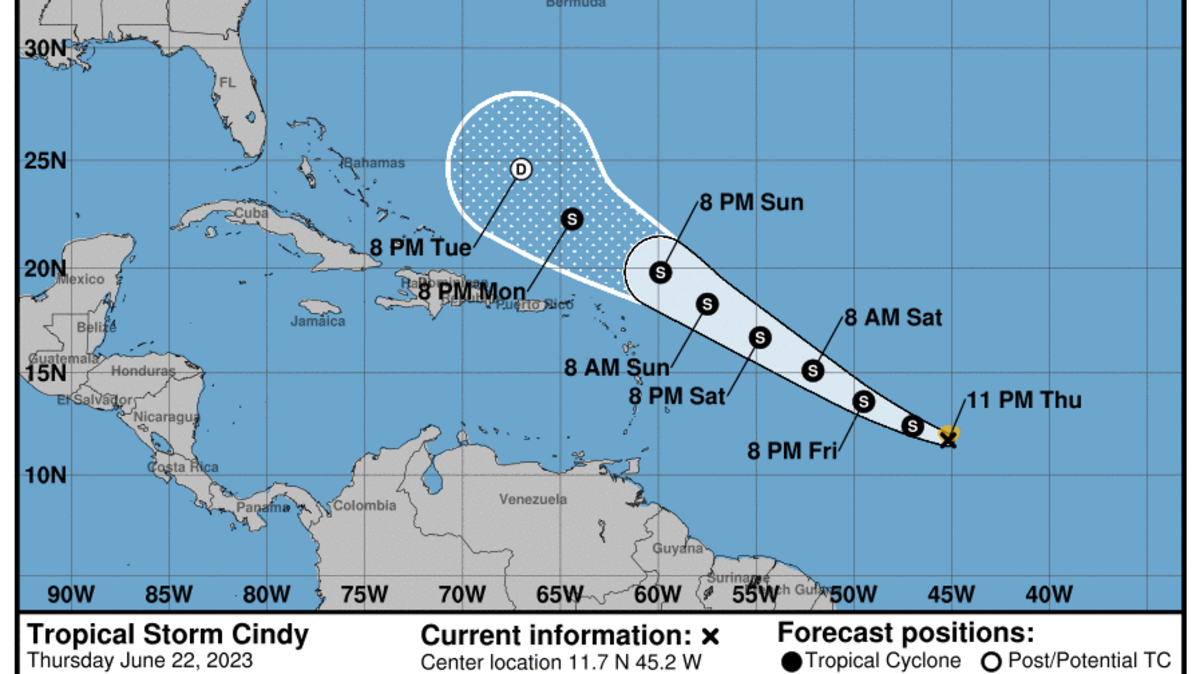
That depression developed into Tropical Storm Cindy late Thursday, according to the National Oceanic and Atmospheric Administration, and forecasters say it will track west-northwest across the Atlantic in the direction of the U.S.
However, Liens said, Cindy is expected to stay hundreds of miles offshore and either dissipate or swerve to the north-northeast without affecting the U.S. coast.
“But as is always the case,” Liens said, “Keep an eye on things because if this one doesn’t get us, we still have a long hurricane season ahead of us.”
This story was originally published June 22, 2023 at 10:57 AM.
