Triple-digit temperatures & damaging winds expected in the Triangle this week
AI-generated summary reviewed by our newsroom.
- Temperatures will reach mid-90s this week, feeling as high as 105 degrees.
- A cold front may bring rain, 60 mph winds and lower humidity.
- Heat returns by weekend, with highs climbing back toward the upper 90s by Monday.
Triangle residents are already experiencing high temperatures — and it’s not going to get better, at least for a couple of days.
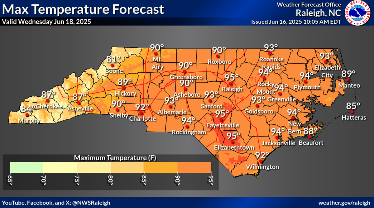
Forecasters are expecting temperatures in the mid-90s starting Wednesday, June 18, lasting through Thursday, June 19, before a cold front moves through the area.
The front, which is expected to bring rain and damaging wind gusts, will briefly bring down temperatures and humidity, said Tom Green, a meteorologist at the National Weather Service Forecast Office in Raleigh.
Here’s what to expect this week.
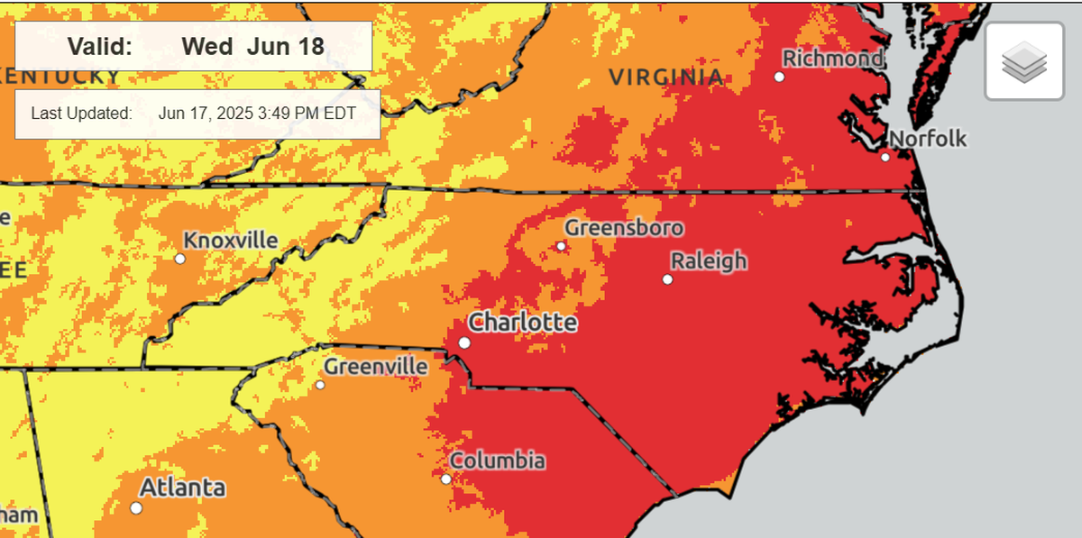
How hot will it get in the Triangle?
While temperatures are expected to be in the mid-90s June 18-19, the feels like temperature will be higher, Green said, between 100 and 105 degrees.
The National Weather Service issued on Tuesday, June 17, a hazardous weather outlook for central North Carolina counties including Orange, Durham, Franklin, Lee, Chatham, Wake and Johnston, saying temperatures “will soar to potentially dangerously high levels this weekend.”
.png "Heat_Index_SFC-Day3State (1).png")
A front moving through the Triangle on Thursday night will bring temperatures down to about 90 degrees on Friday. The front will also lower humidity, making it feel cooler.
But after Friday, the weather is expected to warm again, with high temperatures in the low 90s on Saturday, June 21; mid-90s on Sunday, June 22; and upper 90s to start off next week, Green said.
Chance for severe weather this week
As the front moves through the Triangle on Thursday, it brings a chance of severe weather, Green said.
The main concern is damaging wind gusts, which could reach up to 60 mph Thursday evening.
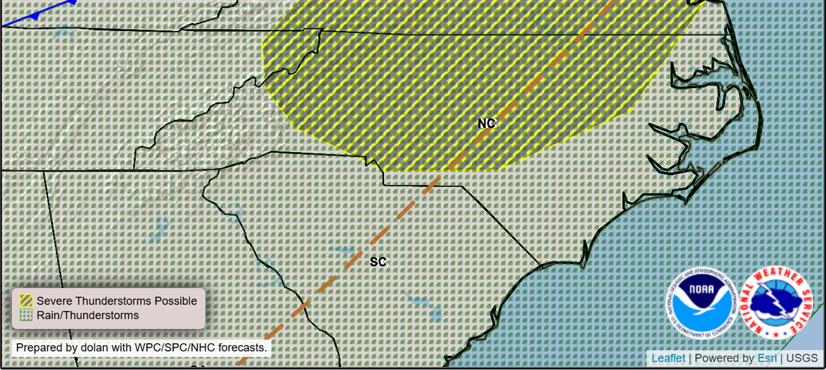
The front is also expected to bring rain, possibly up to half an inch in some places, Green said.
“Scattered strong to severe thunderstorms” may come Thursday afternoon and evening, according to the hazardous weather outlook issued June 17.