Thunderstorms & flash flooding possible today in the Triangle. Latest forecast
AI-generated summary reviewed by our newsroom.
- Flash flood warnings are in place for Chatham and Lee counties Tuesday morning.
- Triangle areas received more than an inch of rain by Tuesday morning.
- Temperatures expected to reached 90 degrees, with heat indices in the upper 90s.
Showers and thunderstorms are coming to the Triangle, making flash flooding possible on Tuesday, July 15.
The National Weather Service issued a flash flood warning for southern Chatham County and northern Lee County, in effect until noon Tuesday. Flash flooding could occur in Sanford, Goldston, Cumnock, Moncure, Shearon Harris Reservoir and Jordan Lake, according to the NWS.
Another flash flood warning is in effect for northeastern Chatham County until 10:30 a.m. Tuesday. Locations that could experience flash flooding include Durham, Pittsboro, Seaforth Boat Dock, Crosswinds Boating Center, Jordan Lake State Recreational Area, Jordan Lake, Crosswinds Campground and Fearrington, according to the NWS.
Weather forecast for Raleigh, Durham
For most of central North Carolina, rain chances for the afternoon July 15 are isolated to scattered, said Laura Helock, a meteorologist at the National Weather Service in Raleigh.
A flash flood warning issued early Tuesday morning included parts of Durham and Wake counties, but those areas were removed around 8:20 a.m., when heavier rainfall moved out of the area, Helock said.
High temperatures are expected to reach around 90 degrees in the Triangle, with heat indices in the upper 90s.
Conditions in the Triangle on Wednesday, July 16 are expected to be similar to Tuesday’s, with temperatures in the low 90s and heat indices in the upper 90s. There’s also a chance of thunderstorms, but with less coverage compared to previous days.
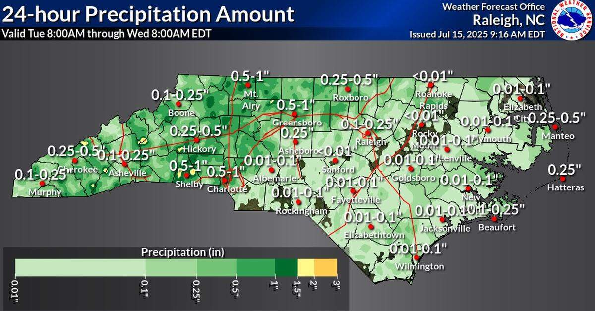
How much rain in the last 24 hours
As of publication, parts of the Triangle received between 0.1 inches and 1.4 inches of rain since Monday morning, according to U.S. Geological Survey data.
Showers and storms expected across the region come a week after the remnants of Tropical Storm Chantal killed at least six people, injured dozens, flooded roads and neighborhoods in central North Carolina and caused an estimated $56 million dollars of damage in Orange County.