Chill and snow will bring a ‘raw, awful day’ to the Triangle, but no buildup
READ MORE
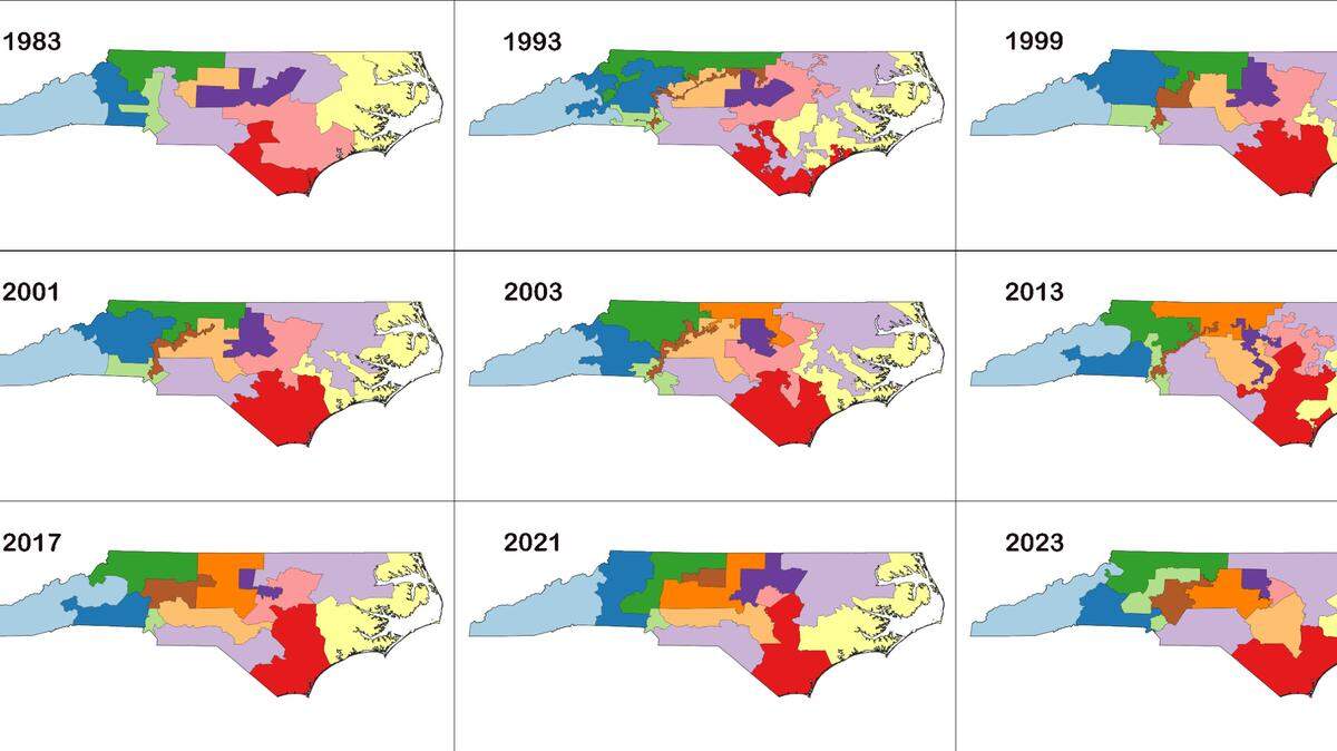
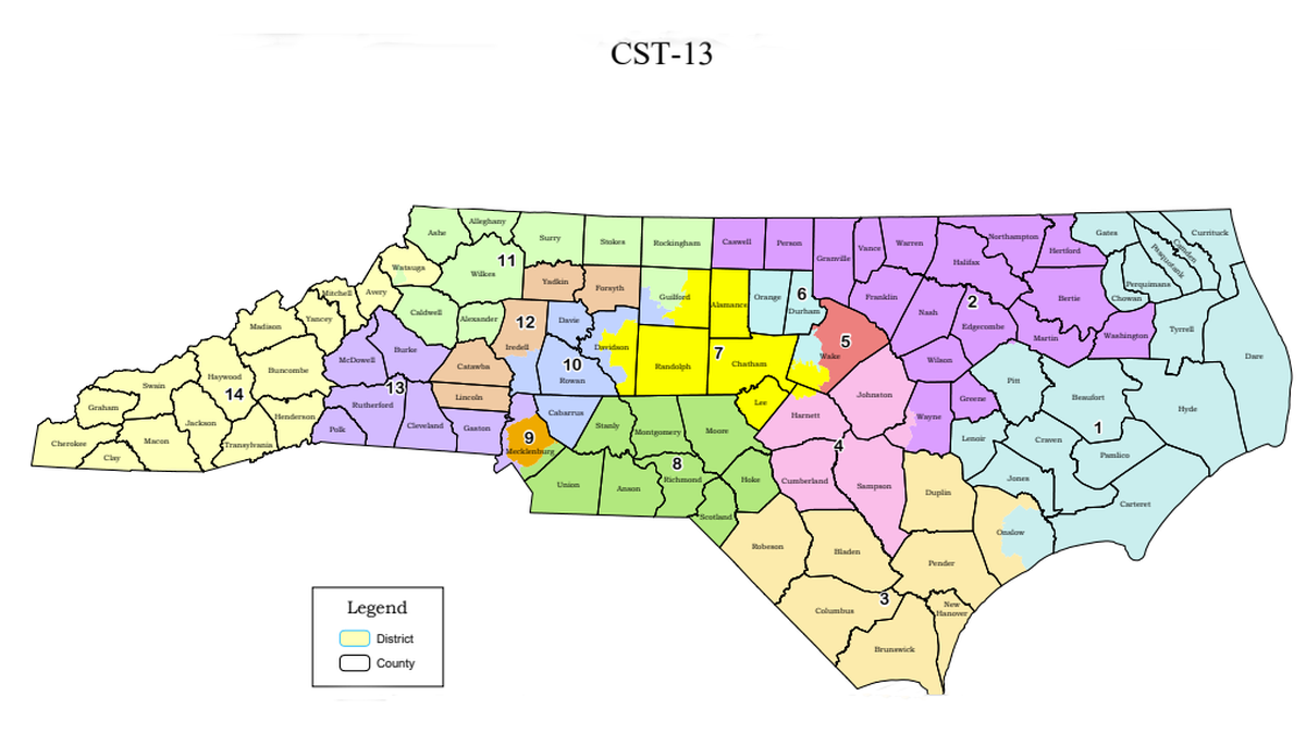
Maps Under the Microscope
At least once a decade, state lawmakers rebuild North Carolina’s election maps. This process of redistricting carries a set of rules. But those rules – and how well mapmakers follow them – get intense scrutiny from the courts almost as soon as the maps become law. This is The N&O’s special report: “Political Maps under the Microscope.”
Expand All
Gerrymandered or no? How will courts judge new North Carolina political maps?

A guide to the three gerrymandering lawsuits challenging NC’s political maps
Meet the judges who could soon rule on North Carolina’s redistricting lawsuits
Podcast: Explore North Carolina’s long history of gerrymandering election maps
Want to design NC redistricting maps? Here’s an app to draw your own political lines.
A week of shorts-and-sandals sunshine will end drastically Monday as the Triangle likely wakes to snowfall.
The ground remains warm after a week of temperatures in the 70s, so the flakes will probably melt without any buildup.
But the transition to freezing temperatures after a balmy stretch will shock the Triangle on the day most holiday vacations end.
“It’s going to be a raw, awful day,” said ABC-11 meteorologist Steve Stewart. “I think winter is fed up.”
Orange County public schools announced plans to close schools Monday because of the weather.
Flooding risk
The Raleigh area had already seen about an inch of rain as of midday Sunday, and another 2 to 3 inches was expected to accumulate as rainfall intensifies overnight Sunday into Monday.
The National Weather Service issued a flood watch from midnight through Monday morning for all Triangle counties.
“That’s the bigger story in the Raleigh area,” said Barrett Smith, meteorologist with the weather service.
There was a potential for flash flooding around midnight, Smith said.
South and east of the Triangle, including around Fayetteville, there was a chance for severe weather including isolated tornadoes.
Snow in forecast
Raleigh saw record-high temperatures over the weekend, but around 7 a.m., overnight rainfall is expected to transition into snow.
Near the Virginia border, Stewart said, snow could accumulate an inch or two.
The National Weather Service issued a winter weather advisory for Granville and Person counties.
But ground freezes more slowly than the air, so the Triangle’s flakes will quickly disappear.
The snowfall could last until noon, and the temperature will fall into the 30s, Stewart said.
Winds out of the north will make the air feel even colder with wind chills dipping into the 20s.
Stewart noted he has never predicted snowfall so soon after a 79-degree day.
It will be a cold, wet welcome to January.
“This is going to be a shock to the system,” he said. “It’s just going to take people by surprise.”
This story was originally published January 2, 2022 at 11:59 AM.