What’s the difference between a storm watch vs. warning? Weather terms explained
READ MORE
Your Storm Watch Guide
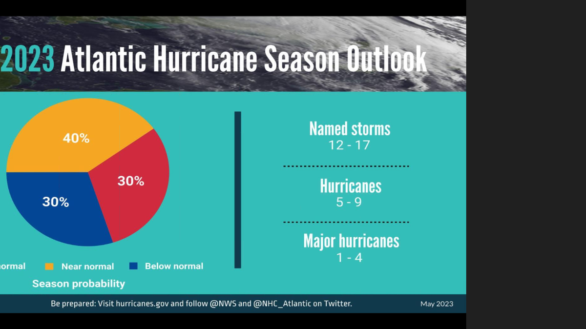
June marks the beginning of the Atlantic Hurricane Season, and that means preparations are underway across the Gulf and Atlantic Coast states. In North Carolina, weather is already a big deal, but the threat of powerful cyclones marks a new level of danger. While we cannot predict the future, we do know that preparation is key. Use this guide to get ready before storms arrive.
Expand All
When severe weather of any kind is possible, you’re likely to see the watches and warnings issued by the National Weather Service, telling you that dangerous weather could be on the way.
When you see those alerts — which you’re likely to get through notifications on your phone or scrolling across your TV screen — you may have questions.
What’s the difference between a watch and a warning? And what do the terms actually mean for specific weather events?
To help you understand the advisory system and how it relates to several types of weather events common in North Carolina, we’ve compiled information from the North Carolina Climate Office and the National Weather Service.
Here’s what to know.
What’s the difference between watch and warning?
Let’s start with what the terms “watch” and “warning” mean in general.
Here’s how the National Weather Service (NWS) defines the terms:
▪ A watch is issued when there is a significant risk of hazardous or severe weather, but the “occurrence, location or timing” of the weather event is “still uncertain.” The timing of when a watch is issued depends on the weather event; for some events, a watch can be issued up to a day in advance, while others can be issued 36 to 48 hours out from the anticipated event.
▪ A warning is issued when a severe or hazardous weather event is actively occurring, imminent or likely to occur. When a warning is issued, it means the weather conditions “pose a threat to life or property,” and people in the path of the weather event should take action to protect themselves.
The NWS can also issue an advisory for weather events.
▪ Similar to warnings, advisories are issued when hazardous weather conditions are “occurring, imminent or likely” — but unlike warnings, advisories are generally issued for conditions that are less serious than warnings.
▪ When an advisory is issued, the weather event may cause “significant inconvenience,” though if caution is not used, the events “could lead to situations that may threaten life or property.”
Tropical storm watch vs. warning
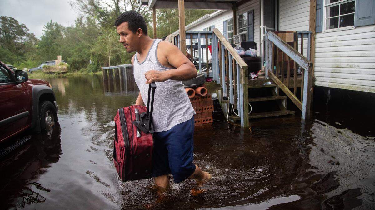
Tropical storms and hurricanes are types of storms called tropical cyclones — a rotating low-pressure weather system that has organized thunderstorms. The storms can bring large amounts of rain, high sustained winds, dangerous storm surges, tornadoes and rip currents.
▪ The NWS issues a tropical storm watch when a tropical cyclone with winds between 39 to 73 mph poses a threat within the next 48 hours.
“The watch does not mean that tropical storm conditions will occur,” the NWS says. “It only means that these conditions are possible.”
▪ The NWS issues a tropical storm warning when a tropical cyclone with sustained winds between 39 to 73 mph or higher is expected and likely within the next 36 hours.
In both tropical storm watches and warnings, the winds associated with the storm systems can be accompanied by other severe weather conditions, including storm surge, coastal flooding and river flooding.
Hurricane watch vs. warning
▪ The NWS issues a hurricane watch when hurricane-like conditions — including storm surge, coastal flooding and river flooding — and winds of 74 mph or higher could occur and pose a threat within the next 48 hours.
“The watch does not mean that hurricane conditions will occur,” the NWS says. “It only means that these conditions are possible.”
▪ The NWS issues a hurricane warning when hurricane-like conditions and sustained winds of 74 mph or higher are expected within 36 hours.
Even after winds die down, the hurricane warning may remain in place, depending on other conditions.
“A hurricane warning can remain in effect when dangerously high water or a combination of dangerously high water and exceptionally high waves continue, even though winds may be less than hurricane force,” the NWS says.
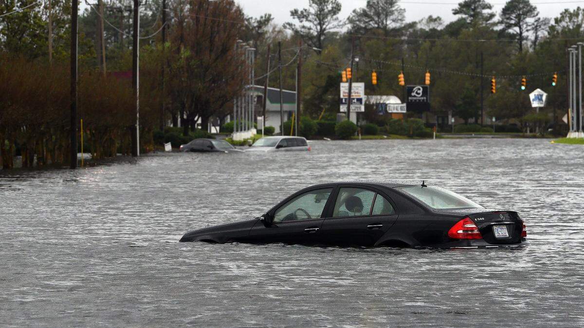
Flash flood watch vs. warning
Flash floods are a type of flooding generally associated with slow-moving thunderstorms, or multiple thunderstorms that move over the same area in a short time. The floods can occur quickly — generally within six hours of a rain event, the NWS says — and can be very dangerous.
Flash flooding can occur anywhere, but mountainous streams and rivers, urban areas, low-lying area, storm drains and culverts are areas considered most susceptible.
▪ The NWS issues a flash flood watch “when conditions are favorable for flash flooding.” The watch does not mean flash flooding will occur, but it is possible, the NWS says.
▪ The NWS issues a flash flood warning “when flash flooding is imminent or occurring.”

Other types of flooding: river, areal flooding
In addition to flash floods, there are other types of flooding you might receive alerts for on your phone, or see on TV weather reports.
River flooding occurs when the water in a river rises above its banks and causing flooding in the area around it.
▪ The NWS issues a river flood watch when ”river flooding is possible at one or more forecast points along a river.”
▪ The NWS issues a river flood warning when “river flooding is occurring or imminent at one or more forecast points along a river.”
Areal flooding generally develops more gradually and over a longer period of time than flash flooding. It is typically associated with prolonged, persistent rainfall that is moderate to heavy.
The flooding normally occurs more than six hours after the rainfall begins, and may cover a large area, the NWS says.
“However, even though this type of flooding develops more slowly than flash flooding, it can still be a threat to life and property,” the NWS says.
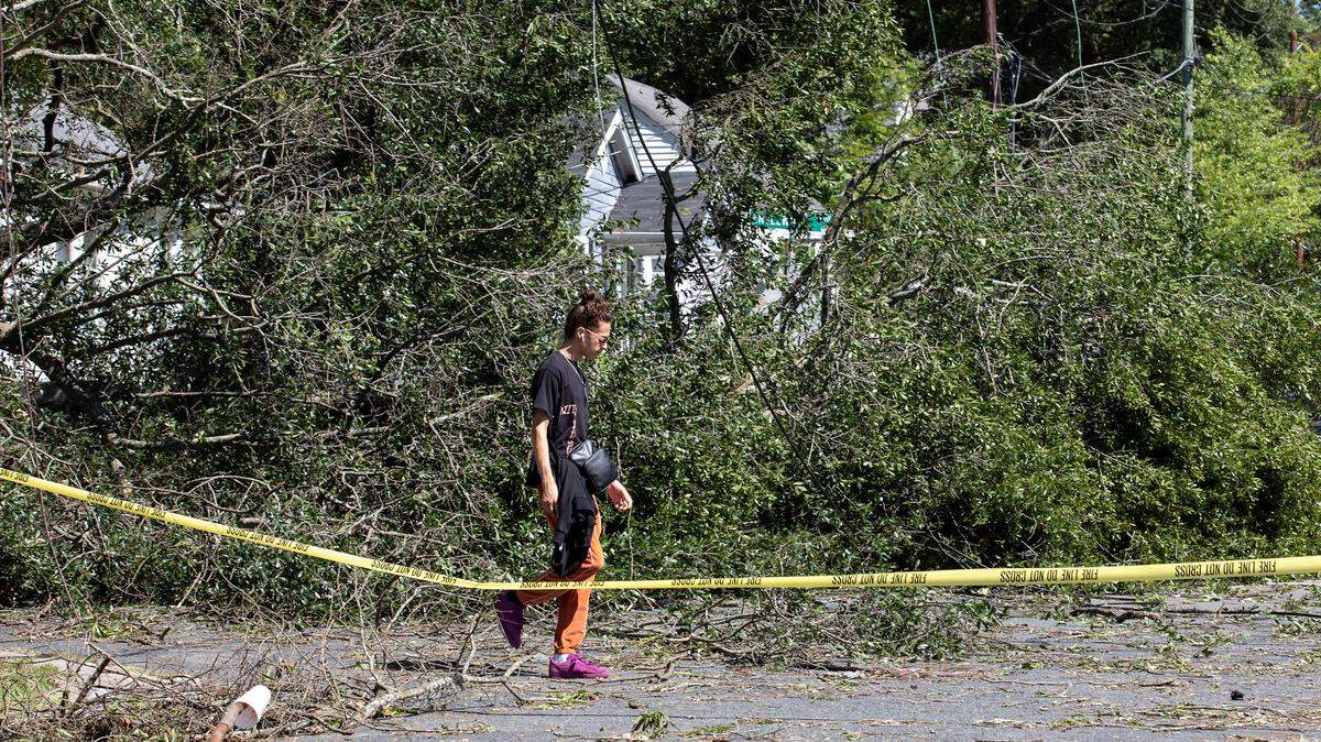
Severe thunderstorm watch vs. warning
Severe thunderstorms are defined as storms with winds of 58 mph or higher and/or hail with a diameter of at least one inch.
▪ The NWS issues a severe thunderstorm watch when such storms are “possible in and near the watch area.”
▪ The NWS issues a severe thunderstorm warning when such storms are “occurring or imminent in the warning area.”
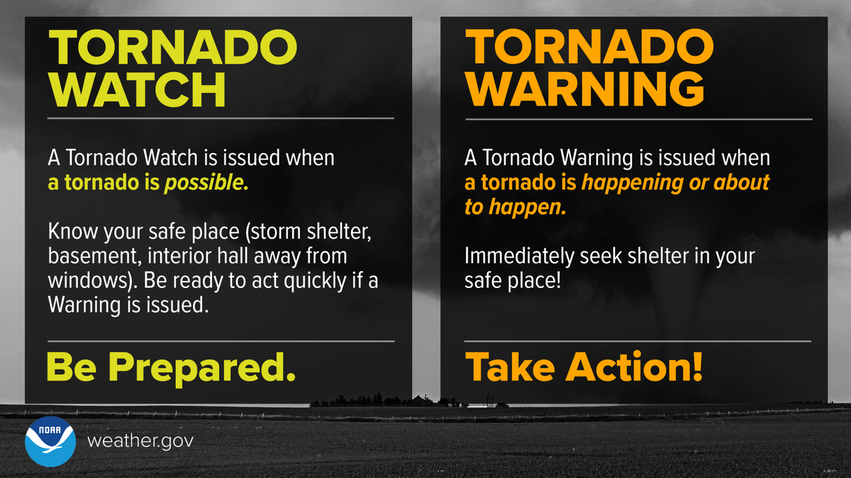
Tornado watch vs. warning
▪ The NWS issues a tornado watch when severe thunderstorms and tornadoes are possible in and near the area for which the watch was issued.
The watch does not mean a tornado will occur, the NWS says, but it means they are possible.
▪ The NWS issues a tornado warning when a tornado is imminent, or one has been has been sighted in your area or on radar.
When a tornado warning is issued, you should seek shelter immediately.

This story was originally published November 10, 2022 at 11:00 AM.

.jpg)


.JPG)
.JPG)
.JPG)
.JPG)